Death Valley National Park: How to Visit, When to Go, and What to Expect
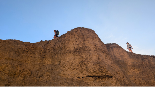
Death Valley National Park stands as the hottest place on earth, drawing more than 1.3 million visitors annually to witness its shimmering salt flats and multicolored badlands. Straddling the California-Nevada border, Death Valley National Park protects more than 3.4 million acres, making it the largest national park in the lower 48 states. Its extremes are part of the draw: the lowest point in North America sits just miles from 11,000-foot peaks, and a landscape that looks lifeless in the afternoon sun turns into one of the best stargazing destinations in the country after dark. Whether you’re planning a day trip from Las Vegas or a multi-day desert road trip, here’s what to see, do, and know before you go.
At a Glance
- Location: Eastern California, along the Nevada border, roughly two and a half hours from Las Vegas and about five hours from Los Angeles.
- Size: More than 3.4 million acres, the largest national park in the contiguous United States.
- Entrance fee: $30 per vehicle for a seven-day pass, $25 per motorcycle, or $15 per person on foot or bike. An annual Death Valley pass costs $55, and the America the Beautiful Pass covers entry as well.
- Main hub: Furnace Creek Visitor Center, home to exhibits, trip planning help, and the park’s main services.
- Nearby towns: Pahrump and Las Vegas, Nevada, to the east; Lone Pine, California, and Panamint Springs to the west.
The park does not accept cash at entrance stations or campgrounds, so bring a credit or debit card. Passes can be purchased online in advance or in person at Furnace Creek Visitor Center and the Stovepipe Wells Ranger Station.
Scenic Drives Worth the Trip
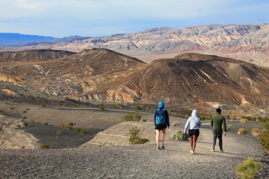
Death Valley’s scale means most visitors see the park by car, moving between overlooks and short walks rather than long treks.
Artist’s Drive is a nine-mile, one-way paved loop off Badwater Road that winds through the Black Mountains. Its signature stop, Artists Palette, is a hillside streaked with red, orange, yellow, blue, pink, and green, the result of oxidized metals in ancient volcanic deposits. Sunrise and sunset bring out the color best.
Badwater Road connects many of the park’s most iconic stops, running south from Furnace Creek past Artist’s Drive, Devil’s Golf Course, and Badwater Basin itself.
Twenty Mule Team Canyon, just east of Zabriskie Point, is a 2.5-mile, unpaved, one-way road winding through golden badlands, named for the 20-mule teams that once hauled borax out of the valley.
Further out, Dante’s View, on a ridge of the Black Mountains, rises more than 5,500 feet above Badwater Basin below, with the Panamint Range visible across the valley. It’s about a 45-minute drive from Furnace Creek.
Zabriskie Point, Golden Canyon, and the Best Hiking Trails
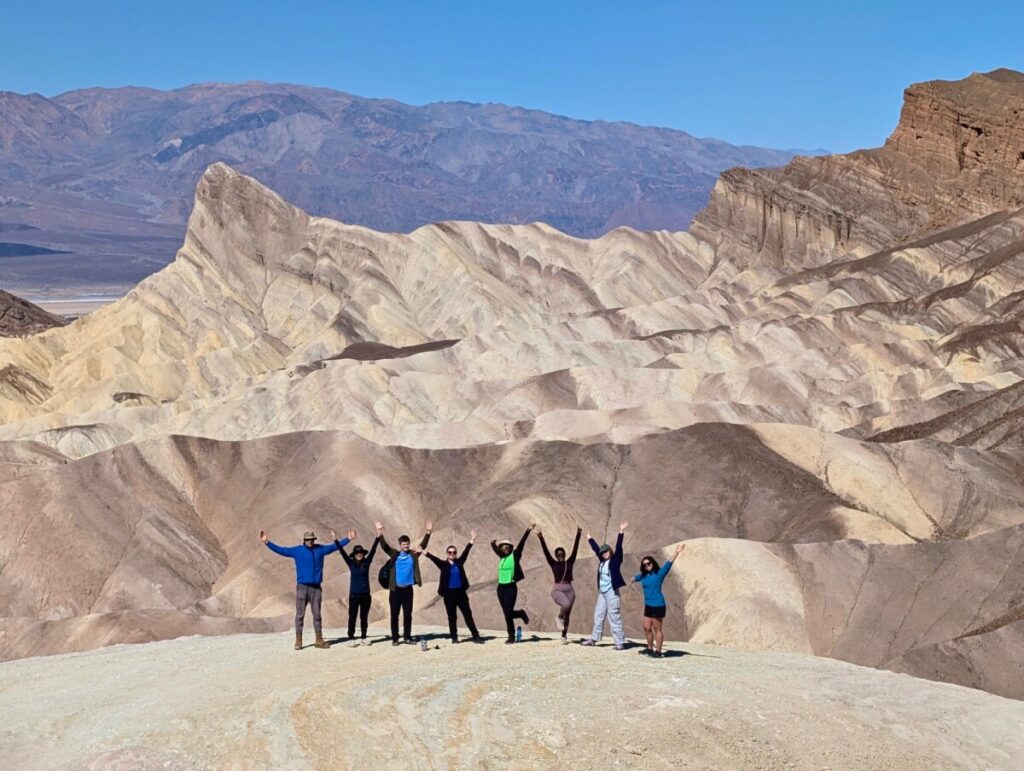
Zabriskie Point is one of the most photographed spots in the park, a golden-hued overlook of eroded badlands and the eroded spire known as Manly Beacon. It’s a favorite for sunrise, when low light turns the badlands gold and orange.
From Zabriskie Point, hikers can drop into Golden Canyon on the Golden Canyon Trail, a route that winds between narrow canyon walls before reaching Red Cathedral, a set of towering red rock formations. Many hikers connect Golden Canyon, Red Cathedral, and Zabriskie Point into a badlands loop back through Gower Gulch, a route the National Park Service lists at 7.8 miles round trip and one of the best introductions to the park’s geology. For a shorter option, the walk to Red Cathedral and back is about 2.5 miles round trip.
Badwater Basin: The Lowest Point in North America
At 282 feet below sea level, Badwater Basin is the lowest point in North America. A boardwalk leads out onto the basin’s cracked, honeycombed salt flats, remnants of an ancient lake that evaporated thousands of years ago. Nearby, Devil’s Golf Course protects a different kind of salt formation: jagged, wind-carved spires too rough to walk on comfortably, let alone play a round of golf, which is how the spot got its name.
Mesquite Flat Sand Dunes and Ubehebe Crater
Near Stovepipe Wells, the Mesquite Flat Sand Dunes are the park’s most accessible dune field, rising up to 100 feet and best explored at sunrise or sunset when shadows define their ripples.
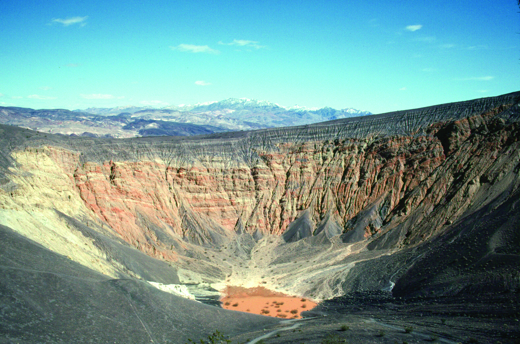
At the park’s northern end, Ubehebe Crater is a half-mile-wide volcanic crater, formed when rising magma met groundwater in a steam explosion an estimated 2,100 years ago. A rim trail circles the crater’s edge, with views down 500 to nearly 800 feet to its floor, depending on where you’re standing.
History and Culture
Long before it became a national park in 1994, Death Valley was home to the Timbisha Shoshone people, who have lived in the valley for centuries and remain connected to the land today. Later, the discovery of borax brought miners and, eventually, tourists.
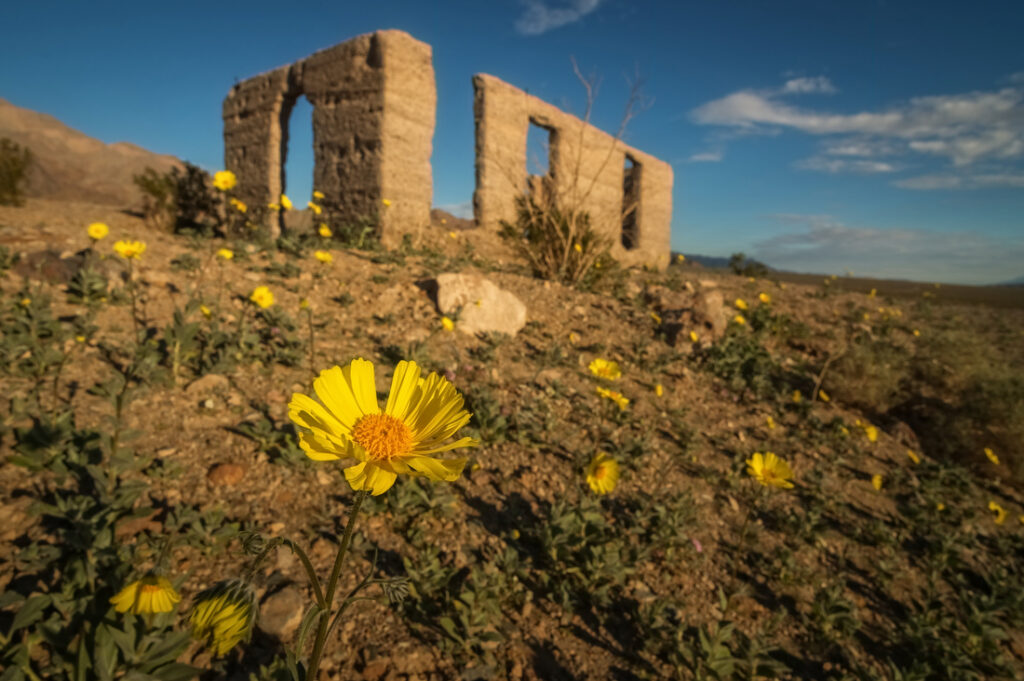
Harmony Borax Works, a short walk from Furnace Creek, preserves the ruins of the 19th-century borax refining operation whose 20-mule team wagons hauled borax 165 miles to the nearest railroad and became the industry’s enduring symbol. Near the park’s eastern entrance, the ghost town of Rhyolite, a boomtown-turned-bust about 35 miles from Furnace Creek on the way to Beatty, Nevada, offers a glimpse of the mining era’s rapid rise and fall.
North of Furnace Creek, Scotty’s Castle, a Spanish-style mansion built in the 1920s, has been closed since a 2015 flash flood damaged the site, followed by a later fire. Limited ranger-led walking tours of the grounds are currently available by advance reservation while repairs continue, though full reopening remains years away.
Wildflowers and Seasonal Highlights
In years with well-timed winter rain, Death Valley produces a striking desert wildflowers bloom that can run from mid-February into June, with low-elevation flowers typically peaking in March and April and higher-elevation blooms following into early summer. Bloom intensity varies widely year to year, so check current conditions before planning a trip around it.
Camping and Lodging
Furnace Creek Campground is the park’s main developed campground, open year-round and within walking distance of Furnace Creek Visitor Center. Texas Springs, a smaller seasonal campground nearby, offers a quieter option during cooler months.
For visitors who prefer a roof overhead, The Inn at Death Valley and The Ranch at Death Valley, both at Furnace Creek, range from historic luxury to family-friendly casual. Near the sand dunes, the Stovepipe Wells Village Hotel offers simple rooms and a general store. On the park’s west side, Panamint Springs Resort provides lodging, camping, food, and fuel for visitors approaching from that direction.
Gateway Towns: Las Vegas, Pahrump, and Lone Pine
Most visitors arrive through Las Vegas, about two and a half hours from Furnace Creek and the closest major airport, or through Pahrump, a smaller Nevada town roughly an hour closer to the park’s eastern entrance. Travelers coming from Los Angeles, about three hours away, often enter from the south. On the west side, Lone Pine, California, and the Panamint Springs outpost in the Panamint Range serve as the last stops before the park for anyone approaching via US-395.
Know Before You Go
Cell service does not work in most areas of the park, according to the National Park Service, and there is no public transportation to or within Death Valley. Download offline maps and directions before you arrive, and travel prepared to self-rescue if your vehicle breaks down.
Gas stations are similarly scarce, with fuel available only at Furnace Creek, Stovepipe Wells, and Panamint Springs, often at a premium. Fill your tank before entering the park and don’t let it run low between stops.
Death Valley earns its reputation as the hottest place on earth: Furnace Creek recorded 134°F in 1913, the highest air temperature ever reliably measured on the planet. Summer visits require serious heat precautions, including extra water, limited exertion during peak hours, and a reliable vehicle.
Flash floods are a real hazard, especially during summer thunderstorms, when narrow canyons and washes can fill with fast-moving water in minutes. Check the forecast and avoid canyon hiking during and after storms.
Stargazing in One of the Darkest Places in the Country
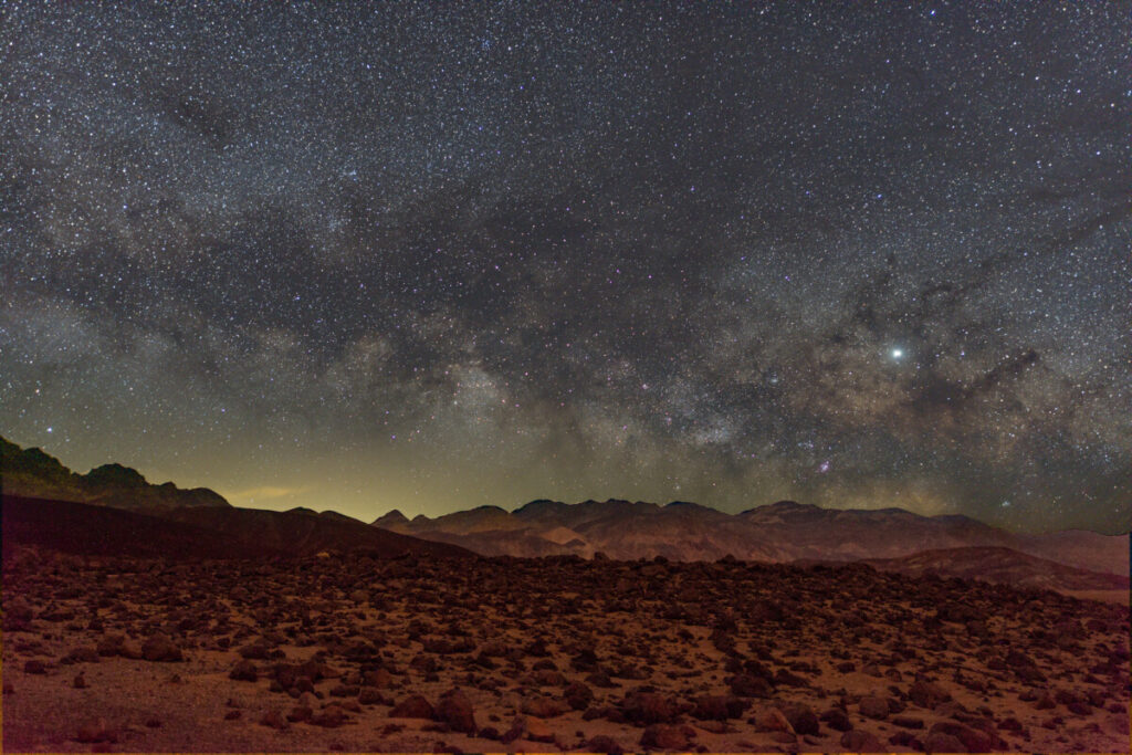
Death Valley has held Gold Tier International Dark Sky Park status since 2013, one of only a few national parks with that top rating, and its remote location and dry air make it one of the best stargazing destinations in the United States. Badwater Basin, Mesquite Flat Sand Dunes, Harmony Borax Works, and Ubehebe Crater are all popular after-dark spots, especially around a new moon.
Why Land Protection Matters in America’s National Parks
National parks protect more than scenery. Places like Death Valley hold natural resources such as dark night skies and fragile desert ecosystems alongside cultural resources like the mining-era sites and Timbisha Shoshone homeland woven through the valley — the kind of natural and cultural heritage found across the National Park System. Keeping these places protected means ensuring these important landscapes and stories are there for current and future generations to enjoy.
National Park Trust is an independent 501(c)(3) nonprofit that acts when at-risk land inside or alongside national parks becomes available, acquiring and holding those parcels until they can be transferred into permanent park protection. The organization also works to expand access to parks nationwide through programs such as Kids to Parks Day, Buddy Bison, and the College Ambassador Program, helping young people and first-time visitors build a connection to public lands that leads to lifelong stewardship. In 2025, that work brought a group of Georgia State University students to Death Valley as part of a multi-park outdoor recreation trip, giving several first-time desert travelers their introduction to the park’s dunes, badlands, and salt flats.
Frequently Asked Questions
What is the entrance fee for Death Valley National Park? A seven-day vehicle pass costs $30, with $25 for motorcycles and $15 per person for those arriving on foot or bike. An annual Death Valley pass is $55, and the America the Beautiful Pass is also accepted.
Is there cell service in Death Valley National Park? Cell phones do not work in most areas of the park, per the National Park Service. Visitors should download offline maps before arriving and let someone know their travel plans.
Why is Death Valley called the hottest place on earth? Furnace Creek recorded an air temperature of 134°F in 1913, the highest reliably recorded temperature on the planet. Summer temperatures regularly exceed 120°F.
When is the best time to visit Death Valley? Late fall through early spring, roughly November through April, offers the most comfortable temperatures for hiking and sightseeing. Summer visits are possible but require significant heat precautions.
Support Land Protection in America’s Parks
Places like Death Valley National Park depend on land being protected before it’s lost. Visit National Park Trust’s Ways to Support page to learn how you can help protect at-risk park land and help more first-time visitors experience places like Death Valley for themselves.
About National Park Trust
National Park Trust is an independent, nonpartisan 501(c)(3) nonprofit that has protected national park land since 1983, acquiring missing pieces of our national parks and benefiting 58 national park sites nationwide. Our mission is to preserve parks today and create park stewards for tomorrow.
Our youth education and family initiatives — Buddy Bison School Programs, College Ambassador Program, and Military Family Programs, along with National Kids to Parks Day — connect tens of thousands of people to the outdoors each year.
We believe public parks, lands, and waters should be cared for, enjoyed, and preserved by all, for current and future generations. Learn more at parktrust.org.